
LITTLE KNOWN FACT, there is no universally accepted definition of a mountain. Look at any dictionary. You’ll find no specific metric—not elevation, volume, steepness, spacing—to define a mountain.
I define “mountain” as my happy place. Ask me my favorite hike and I’ll say, “All of them,” or, “My next one.” So, when the world started to open up slowly this spring after months of sheltering in place, I knew where I could seek solace and literally expand my horizon, with plenty of space to socially distance.
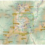
Here on Cape Ann, we are blessed to be only a car drive’s distance to the White Mountains in New Hampshire. The White Mountain National Forest (“WMNF”) has a total area of 750,852 acres, or 1,225 square miles. It has six designated Federal Wilderness Areas: the 27,380-acre Presidential Range/Dry River Wilderness, the 5,552-acre Great Gulf Wilderness, the 45,000-acre Pemigewasset Wilderness, the 35,800-acre Sandwich Range Wilderness, the 12,000-acre Caribou/Speckled Mountain Wilderness, and the 23,700-acre Wild River Wilderness that are protected from commercial industries and are used solely for recreational and scientific purposes. There are over 1,200 miles of hiking trails and 23 campgrounds within the WMNF, including over 160 miles of the Appalachian Trail as it traverses the Granite State. There’s a trail experience for virtually everyone, and anyone.
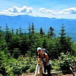
Since May 30th, I’ve summited sixteen mountains in the White Mountain National Forest: Mt. Chocorua (3,478 ft.), the Three Sisters (3340 ft., 3354 ft. and 3354 ft.), Mt. Jefferson (5,712 ft.), Mt. Adams (5,774 ft.), Mt. Moriah (4049 ft.), South Carter (4,430 ft.), Middle Carter (4,610 ft.), Carter Dome (4,832 ft.), Mt. Hight (4675 ft.), Mt. Waumbek (4,006 ft.), Mt. Starr King (3,907 ft.) Mt. Cabot (4,170 ft.), The Bulge (3,940 ft.) and The Horn (3,904 ft.). Many are higher than four thousand feet, but only eight officially count as a “4,000-footer” on the Appalachian Mountain Club’s list of the 48 four thousand footers in New Hampshire. Only five more to go!
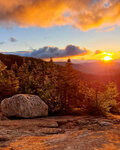
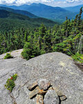
After weeks of quarantine, I headed north for my first hike of the year at 6 a.m. Saturday, May 30. A friend and I tackled one of the “Terrifying 25” trails, (a popular list of difficult White Mountains trails compiled by author Trish Herr, the author of Up A Mother and Daughter’s Peakbagging Adventure – if you are looking for an inspirational book for your daughter that shows “big, bold things are possible.") near Conway, NH. Over gorgeous granite ledges, over the Three Sisters to Mt. Chocorua’s rugged and exposed peak with breathtaking 360° views. We watched the sunset from Mt. Chocorua’s peak, then hiked down 1.5 miles to forage for a fresh water re-supply, to hang a bear bag and camp under the stars. (Camping is not allowed above tree line.) At 4:30 a.m., we hiked up again just to catch the sunrise over the seemingly limitless wilderness. We returned to pack our camp, hiked out and were back in Manchester, with the whole trip completed in less than 27 hours.
Although equipped with masks, we didn’t need them. Apart from a few people at the peak and spotting a few hammocks and other tents set up during the night, we didn’t see a soul. Social distancing perfection.
Next up was the “Carter traverse” to hike Carter Dome, Mt. Hight, South Carter and Middle Carter mountains north of Jackson, NH. 15.5 miles of hiking that included the 19 Mile Brook Trail, that was littered with quartz flakes. Beautiful.
While well over 4,000 feet elevation, Mt. Hight is not on the 48 4k list but it is stunning, underrated and well worth the side hustle. We hiked while taking part in Summits in Solidarity, a group of hikers that committed to climb a peak to honor George Floyd’s life and observe 8:46 minutes of silence on the summit at noon, to raise their own awareness by reading one of several recommended books on racial justice in America, to take action in their own community and fundraise for Outdoor Afro or another racial justice organization of their choice. Outdoor Afro is a ten-year-old national non-profit with a presence in 30 states that seeks to further Black connections and leadership in nature; to change the face of conservation and lead the way for inclusion in outdoor recreation and conservation for all. Check them out and get involved!
Weeks later, I tackled another Terrifying 25 trail that featured a castellated ridge with castles, ledges and scrambles to bag two of the three highest mountains in the Whites, Mt. Adams and Mt. Jefferson. Even in mid-June, we encountered two massive, steep and unstable snow fields. A friend fell and slid as the snow gave away. Luckily, he fell after passing a sheer drop, when there was only a ten-foot drop to fall breaking, nerve shaking and leg scraping brush. We abandoned hopes of bagging three peaks that day. Rightly so. We hiked out with head lamps in muddy and slippery conditions.
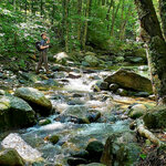
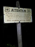
Those who spend a lot of time in the Whites often hear, “never underestimate the mountain,” or, that, “mountains make their own climate.” It’s so true. I’ve taken pictures of sunsets, sunrises, slides, chimneys, ridges, ledges, boulders, water crossings, and wildlife, but the picture that gets the most attention is of a US Forest Service sign that greets hikers at the tree line: “ATTENTION Try This Trail Only If You Are In Top Physical Condition And Carrying Extra Clothing And Food. Many Have Died Above Timberline From Exposure. Turn Back At The First Sign Of Bad Weather.” (Since 1849 over 135 people have died on Mt. Washington and Facebook is frequented with posts by NH Search and Rescue teams about rescues of unprepared hikers.)
I always check mountain forecast before heading out. When I hiked Mounts Tom, Wiley and Field two years ago, it was 65° and sunny as we set out, but snow and sleet met us at the peak and hail chased us as we descended. We started in shorts but finished in wool hats, down layers and waterproof jackets. So, I always hike with the ten essentials and multiple copies of trail maps in Ziplock bags. Anyone who hikes with me does the same. I also renew my annual Hike Safe card, which helps fund NH’s SAR budget. I never want to end up on an episode of North Woods Law.
Each mountain presents unique challenges and gifts. Some are easier than others, but none are truly easy. Some summits are wooded viewless cairns (Hale, Waumbek and Starr King, but the latter two reward you, like many things in life, if you go the extra distance and venture just beyond the summit). Some are hidden, like one of the Carter’s, which I hiked by and had to circle back when I realized I had gone a quarter mile too far. Some summits require scrambles up giant rock piles that seemingly never end (Adams and Jefferson). But many provide majestic views over the humbling ranges and wildernesses that make up the WMNF (Mt. Hight, Chocorua, Jefferson, Adams, Moriah).
Wine vintners will tell you that roots grow under distress. To me, the more challenging a trail, the more fun it is. But perspective is key. False peaks are a challenge to conquer on the way to the real peak. Tree roots and loose rocks require deliberation which quiets the mind and demands that you be here now. River crossings (hopefully) put you in touch with your center of gravity real fast. Finding bear and moose scat is exciting. Being mock attacked by a spruce grouse is fun, once it is over.
I find that appreciation becomes abundant on the trail. Mountain spring water tastes the best. Simple trail food (like almond butter and banana chip sandwiches) is magical when you earn your exhaustion and hunger over miles of elevation gained and lost. An apple never tastes as good as it does on the trail. Sleep comes easily under a blanket of more stars than you have ever seen. Camaraderie amongst hikers helps restore your faith in humanity. So does the ingenuity of people who invent camping gear that weighs mere ounces. How amazing is it to realize that everything you need to survive multiple
days in the wild can, and will, fit in a 50-liter pack on your back!
Whether you solo a mountain or hike it with a friend, the experience changes you.
I hope you find your mountain. Happy trails.